Choose a mission and then successfully build and launch a satellite that can help gather the data required.
Select here for additional information on using this interactive simulation.

This interactive simulation is designed to develop students’ understanding of satellites and their usefulness with real-life research in Aotearoa New Zealand. The simulation requires users to build their knowledge and understanding about the requirements of each mission along with the satellite components needed to successfully launch a satellite that is fit for the mission’s purpose.
The simulation has three missions:
- Find dark vessels fishing illegally
- Track an albatross population
- Monitor Earth movements
At each stage, there is access to a help button and links to additional resources that will support student learning in order to make accurate decisions throughout the satellite build and launch.
Simulation instructions
Click and drag components onto the satellite outline. Components can be added and removed. You will need to select all of the essential components as well as choose the correct payload component for your mission. Choosing the wrong payload means your satellite will not be able to collect data. Hover your mouse or finger over and select the three dots on each component to find out more information about its purpose.
Select a suitable orbit for your satellite’s mission. Choosing the wrong orbit means your satellite won’t be able to collect data.
For optimal viewing, use landscape orientation when using a tablet or iPad.
This is a simulation, so please note there may be small inaccuracies and satellite components and orbits are not to scale.
See the activity Build a satellite for a mission for a mission for additional support in using this interactive simulation.
Related content
These resources provide helpful background information.
Read more about building satellites.
Discover more about using satellites to track:
Activity ideas
Use the data the satellites collect during the simulation to analyse:
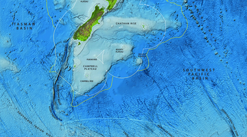
- dark vessels on the Tasman Sea
- albatross nesting sites on a Chatham Islands sea stack
- slow slip Earth movements near the East Coast’s Māhia Peninsula.
Consider doing the activity Interpreting observations from satellite images prior to these activities. It introduces strategies that are useful when interpreting satellite images.
Acknowledgement
This resource has been produced with funding from the Ministry of Business, Innovation and Employment and the support of the New Zealand Space Agency.